
There are two very different ways to spend a day outdoors at Bled. One follows the water, changing the relationship between island, church and castle with every bend. The other climbs into the woods above the western shore and looks back down over the whole composition. Neither experience needs to be a race to collect viewpoints, and the shorter route on a map is not necessarily the easier one underfoot.
This guide helps you choose between a shore walk, Ojstrica, Mala Osojnica and Straža, then fit a swim into the same geographical area. The useful distinction is between a viewpoint, a bathing place and an access point for boats. They can sit close together without being interchangeable. Our suggested sequences are editorial itineraries, not timed walking records or assessments of current trail or water conditions.
Choose the photograph you actually want
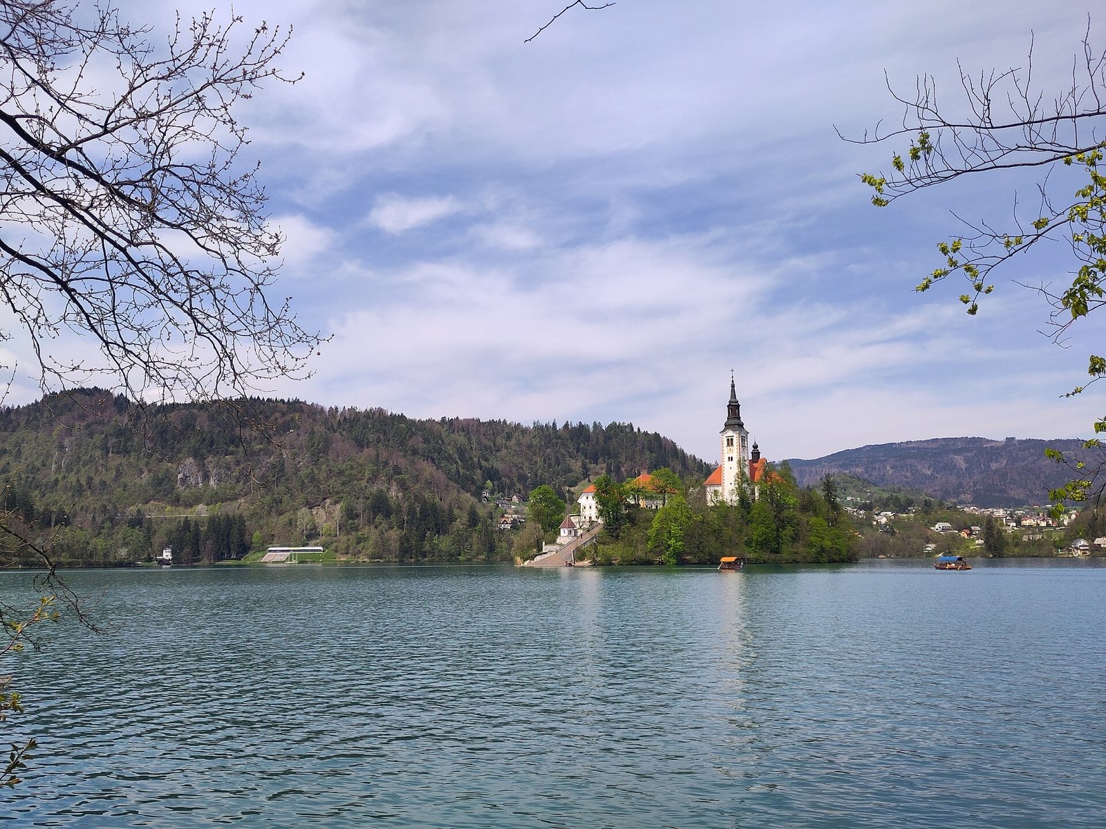
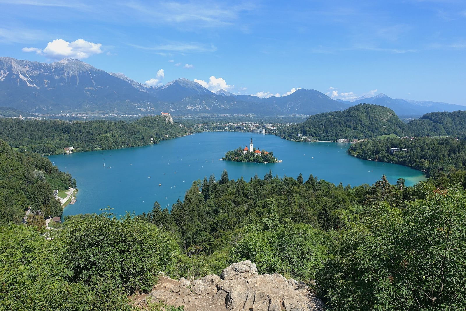
For the familiar composition of the island below you and the castle across the water, start your planning on the western side. Ojstrica and the Osojnica hills provide the elevated perspective; the shore gives you a lower view in which the island church feels much closer. Those are different experiences, not a better and worse version of the same stop.
Choose a single hill if your interest is mainly the view. Adding every nearby summit turns a modest outing into a much longer walk and uses the energy you might otherwise spend enjoying the lake. If somebody in your group dislikes steep ground, agree on a lakeside alternative before setting off rather than making the decision halfway up a narrow forest path.
The lake circuit: build a day from four sides
The approximately 6 km shore route is the simplest way to understand Bled. The town end brings cafés and practical services; the castle side places the cliff above you; the western bays bring the island into a different alignment; and the southern side opens another sequence of water-level views. Think of this as several short walks connected together, not an obligation to complete a lap.
An editorial half-day plan is to walk out from town, stop for a substantial break on the western side and decide there whether to continue around or return. Allowing half a day is a comfort budget with pauses, not an official walking time. If a swim is the priority, keep dry clothing and a return plan in mind from the start instead of finishing the circuit wet and tired.
- Choose the outward shore first; avoid retracing the same stretch solely to reach a booked activity.
- Keep boat landings clear even when they provide an attractive photograph.
Ojstrica: a short ascent with a proper uphill section
The official tourism description places the start near Zaka campsite on the south side of Velika Zaka. Follow the marked forest route and the signs for Ojstrica. The name refers to the pointed shape of the hill. Its appeal is the compact reward: lake, island and castle cliff assemble into one view, with the Karawanks beyond. A bench at the top invites a pause rather than a hurried photograph.
Tourism Bled gives about 20 minutes for the ascent, describing it as short but steep. That is an indicative climb time, not your complete outing: add the approach along the shore, pauses, any waiting for space and the descent. Shoes with grip make more sense here than beach footwear. For a first visit, daylight and a dry path are more useful priorities than copying a sunrise photograph.
If a morning on the western shore is central to your trip, compare Hotel Triglav near Bled Jezero. Check the actual walking route to the trail area as well as your room choice.
Mala Osojnica: allow room for the longer climb
Mala Osojnica offers a wider elevated reading of the lake and its surrounding landscape. The official description gives roughly 45 minutes on a steep forest path; it also describes continuing for about another 20 minutes to Velika Osojnica. These are indicative ascent figures, not a recommended stopwatch target or confirmation that today’s route is suitable.
The decision is whether you want a woodland walk as well as a viewpoint. If you only want a quick look before lunch, Ojstrica or a shore section is the more contained plan. If walking is the main activity, leave enough time to enjoy the climb and return without a fixed boat departure immediately afterwards. Do not extend to Velika Osojnica simply because the name appears on the next sign.
Straža: a different hill, closer to a town-based day
Straža rises on the southern side of Bled and belongs to the resort’s long tradition of outdoor recreation. Tourism Bled describes woodland paths, the Bled Fitness Trail and views toward the lake, castle, Jelovica and Stol. A chairlift is another way to reach the hill when the operator is running it; it is an operating attraction, not a permanently available public lift.
This is a useful alternative if you are staying around town and want to keep the day in that part of Bled. It also provides cultural context: a monument recalls Arnold Rikli, the nineteenth-century pioneer of Bled’s wellness tourism. His historical enthusiasm for air, light and walking helps explain the resort’s landscape; it is not a medical recommendation to reproduce his therapies.
Where to swim: three names worth knowing
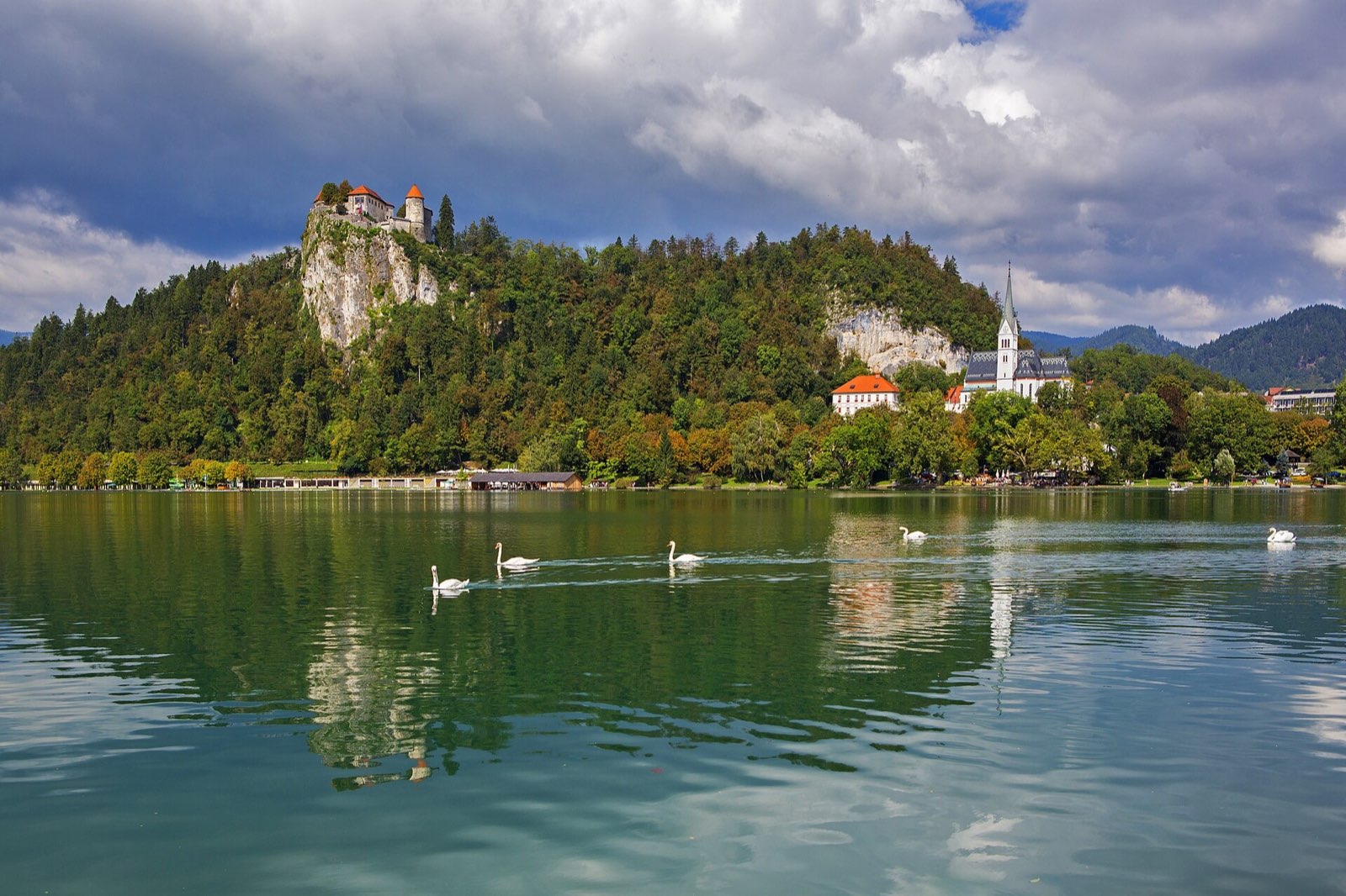
Grajsko kopališče is the established public lido below the castle rock. Mala Zaka and Velika Zaka are also named by Tourism Bled as designated outdoor bathing places. Pick the site according to the day you are already planning: the castle-side lido belongs naturally with the town side, while the Zaka bays make geographical sense with a western-shore outing.
A lido and an open bathing bay provide different kinds of visit. If changing arrangements, toilets or a managed enclosure matter to your group, investigate the current lido offer before choosing a simple shore swim. Hotel bathing areas at Vila Bled and Grand Hotel Toplice are separately listed; do not interpret their presence on the tourism page as free public access or an entitlement included with an unrelated booking.
| Place | Useful fit | Decision to make |
|---|---|---|
| Grajsko kopališče | A town-and-castle-side day | Check seasonal admission and current facilities. |
| Mala Zaka | A western-shore visit | Use the signed bathing access, not a rowing landing. |
| Velika Zaka | A western bay day | Keep the swim separate from the uphill trail outing. |
A western-shore day that does not become a checklist
For an active summer day, an editorial sequence is to reach Velika Zaka, walk to one viewpoint in appropriate conditions, return to the lake, eat and only then decide on swimming. Separating the walk and swim makes it easier to carry the right shoes and keep dry clothes. There is no need to add both Osojnica hills simply because you are already nearby.
If a swim is your main reason for coming, reverse the emphasis: spend the day around one designated bathing place and use the shore for a short stroll. A hill can be optional rather than the price of admission to a relaxing afternoon. For mixed groups, meeting back at the lake works better than asking everyone to commit to the same climb.
If you would rather have part of your outdoor day organised, compare current Bled activities. Choose by meeting point and physical demands; a marketplace listing is not a substitute for today’s conditions.
Read water information as a dated observation
The Slovenian environmental authority provides bathing-water monitoring. Match the named monitoring place to the site where you intend to enter, and look at the observation or reporting date. A good result from a previous season describes that period, not the water at the moment you arrive. Water temperature, depth and supervision are separate questions from laboratory water quality.
Use the local bathing rules even if the surface looks calm. A boat pier is not a general swimming platform, and the island is not a reason to improvise a long crossing. For children or less confident swimmers, plan around the specific bathing facility and supervision arrangements you have checked, rather than treating the whole lake as a controlled pool.
Light, cloud and the decision to stay low
Photography plans often begin with sunrise or sunset, but a first-time visitor also has to solve the unfamiliar approach and descent. This guide does not calculate a safe twilight window. An ordinary daylight walk can still deliver layered mountains, reflections or mist without turning the return into a navigation problem. A photograph made on one clear morning is not a promise for your date.
Use the Slovenian Environment Agency forecast and warnings close to the outing. In rain, ice or poor visibility, replace the climb with a shorter shore section, a town break or a confirmed indoor visit. This keeps the day enjoyable without pretending that every mountain view has an all-weather equivalent. Return for the hill only if conditions and remaining daylight support it.
An overnight stay gives you another opportunity for the view if the first day is cloudy. Compare locations and cancellation conditions rather than assuming a particular room guarantees a mountain panorama.
Three sensible outdoor plans
For a gentle day, choose a short town-side walk, a long café or lunch stop and, in season, a visit to a designated bathing facility. For an active day, make one western viewpoint the principal walk and keep the afternoon on the shore. For a mixed-weather day, leave the hill undecided and start with a lakeside section where turning back is straightforward.
These plans deliberately leave space between activities. Wet clothes, a muddy descent or a longer lunch all affect the next decision. The day builder can help order the wider stay, but the final choice on the day should follow the group’s energy and current official information. The most satisfying outdoor day is often the one in which you stop at a place you like instead of racing to the next named pin.
Sources & editorial notes
Access, timetables and operating conditions can change. Follow the linked official notices before travelling.
Sources & editorial notes →